Lot 1045
1045
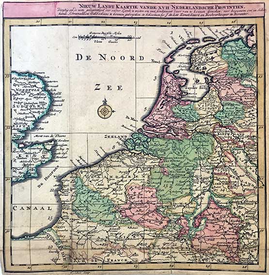
(LAT, J. de). Nieuw en Beknopt Kaart-Boekje, vertoonende de XVII. Nederlandse Provintien. Deventer, Joan de Lat, 1734. W. a fold. general map of the Netherlands, 22 fold. maps and a distance table, all nicely cold. by hand. 8°-obl. Cont. hcf. (Spine rubbed/chafed, top of spine a bit dam., corners bumped, a few rep. on v° of maps, a bit browned in places, but a good copy).
Koeman II, Lat 1b. Joan de Lat was one of the very few booksellers outside Amsterdam who published maps and atlases. He worked at Deventer between ca. 1734-50. The maps of this charming atlas are normally folded in four (as size of title and text-pp.), but here bound unfolded. Size of the general map is 18 x 18 cm.; all other maps have a size 14 x 22 cm. It was reissued by Gravius in Amsterdam ca. 1770.€ 400
result € 400
Back