Lot 1018
1018
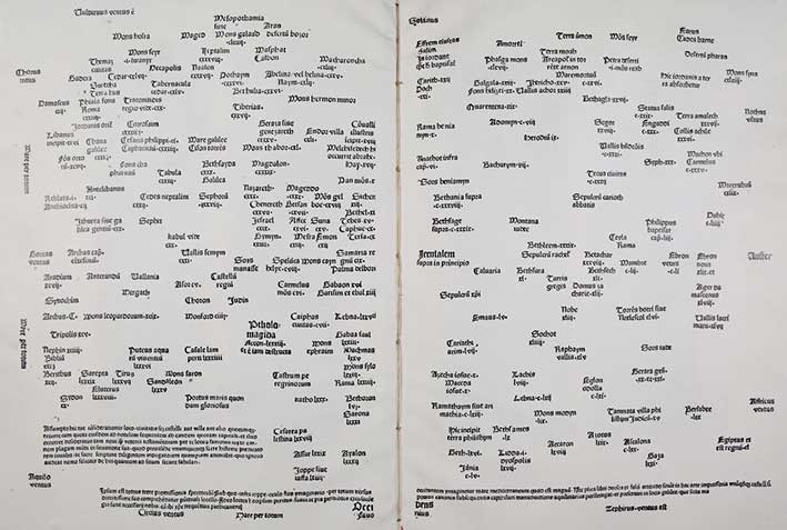
ANONYMI LUBICENSIS ut videtur Hermanni Sinae, ordinis praedicatorum Prologus Arminensis in mappam Terrae Sanctae, Lubicae ante annum MCDLXXX impressus. (Ed.) G.-A. Neumann. Geneva, J.-G. Fick, 1885. 32 lvs. W. ti. printed in red and black, a schematic plan of the Temple of Salomon, a schematic plan of Jerusalem & a douple-p, schematic map of the Holy Land. Fol. Cont. cf. w. gilt dec. on both sides, richly dec. inside dentelles & all edges gilt. (Rebacked in mod. cf. corners a bit bumped/worn, slightly wrinkled by humidity).
Facsimile edition of the first printed description of the Holy Land and Jerusalem (Lübeck, Lukas Brandis, 1478). Printed in 90 copies, one of 50 copies on vellum. Our copy nr. xxxv, printed for Mr. Charles Schefer (1820-98) (also with his bookplate), French diplomat/orientalist and bibliophile. The aim of this work was a systematic, as comprehensive as possible representation of the Holy Land, which should give young preachers a sense of the localization of places and distances. It was both a Bible study tool and an edification book. - Röhricht, Bibl. Geographica Palaestinae, p. 127. Of utmost rarity.€ 1800
result € 0
Back