BELGIUM -- GERARD, P. Kadastrale atlas van Oost-Vlaenderen: Gemeente Zele. 1:2500. N.pl., n.d. (= 1854?). W. 21 double-p. maps, partly col. by hand. Lge-fol. Cont. clothbacked brds. (Bind. dam., small stamps on all maps, maps a bit thumbed, outer upper corner of first map a bit dam., but maps in general in good condition).
€ 700
uitslag € 0
BLAEU, J. Le grand atlas ou cosmographie Blauiana. (Atlas major). (Facs. ed. Amst., 1663). Amst., 1967-68. 12 vols. W. 609 double-p. maps (partly cold.) in facsimile. Lge-fol. Or. imitation vellum w. richly gilt dec. backs & sides. (Some traces of use, small corner of foot of spine of vol. XI a bit dam., but a very good set). Printed in a limited edition of 1000 numb. copies. A complete facsimile of the original edition. -- C. KOEMAN. Joan Blaeu and his Grand Atlas. Introd. to the facs. ed. of Le grand atlas, 1663. Amst., (1970). W. ill. Or. imitation vellum. -- Added: J. BLAEU. Toonneel der steden v.d. Ver. Nederlanden met hare beschrijvingen (Holland & West-Vriesland / Utrecht). (Herdr. ed. 1648). Amst., Bruss., 1966. W. 44 cold facs. of town maps. Lge-fol. Or. bind. -- (14).
uitslag € 1100
BRAUN & HOGENBERG. Civitates orbis terrarum. (Repr. ed. 1572-1618). W. an introd. by R.A. Skelton. Amst., 1965. 6 in 3 vols. W. 363 double-p. plans/views. Lge-fol. Ocl.
€ 150
uitslag € 150
EDSON, E. The World Map 1300-1492. The Persistence of Tradition and Transformation. (2007). -- D. COSGROVE. Apollo's Eye. A Cartographic Genealogy of the Earth in the Western Imagination. (2001). -- M. SPONBERG PEDLEY. The Commerce of Cartography. Making and Marketing Maps in 18th-c. France and England. (2005). -- E.A. SUTTON. Capitalism and Cartography in the Dutch Golden Age. (2015). -- 4 vols. Ocl. w. dust-j. -- And 5 o. on the history of cartography. (9).
€ 70
uitslag € 140
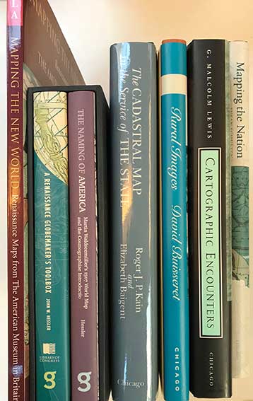
HESSLER, J.W. The Naming of America. Martin Waldseemüller's 1507 World Map and the Cosmographiae Introductio. - Id. A Renaissance Globemaker's Toolbox. Johannes Schöner and the Revolution of Modern Science, 1475-1550. (2008-13). 2 vols. 8°-obl. Obrds. Boxed. -- R.J.P. KAIN & E. BAIGENT. The Cadastral Map in the Service of the State. A history of Property Mapping. (1992). 4°. Ohcl. w. dust-j. -- S. SCHULTEN. Mapping the Nation. History and Cartography in 19th-c. America. (2012). Lge-8°. Ocl. w. dust-j. -- M. LEWIS, ed. Cartographic Encounters. Perspectives on Native American Mapmaking and Map Use. (1998). 4°. Ocl. w. dust-j. -- D. BUISSERET, ed. Rural Images. Estate Maps in the Old and New Worlds. (1996). 4°. Ohcl. w. dust-j. -- And 1 o. (7).
uitslag € 70
HEWSEN, R.H. Armenia. A Historical Atlas. (2001). 4°-obl. Ocl. w. dust-j. First comprehensive and authoritative atlas, does not treat Armenia in isolation, but instead sets it within the context of Caucasia as a whole, providing detailed information on neighboring regions such as Georgia and Azerbaijan. -- Added: S. SEEGEL. Mapping Europe's Borderlands. Russian Cartography in the Age of Empire. (2012). Lge-8°. Ocl. w. dust-j. -- J.R. AKERMAN, ed. The Imperial Map. Cartography and the Mastery of Empire. (2009). Lge-8°. Ocl. w. dust-j. -- J. BLACK. Maps and History. Constructing Images of the Past. (1997). Obrds. w. dust-j. -- And 2 o. (6).
€ 90
uitslag € 100
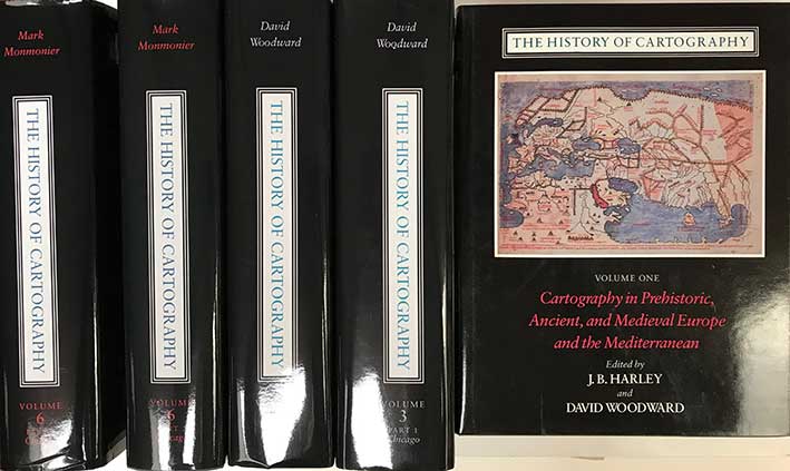
HISTORY OF CARTOGRAPHY. Ed. by J.B. Harley, D. Woodward, G.M. Lewis, (a.o.). Vol. I, II-1-3, III-1-2, VI-1-2. Chicago, (etc.), Univ. of Chicago Press, 1987-2015. 8 vols. Prof. illustr. 4°. Ocl. w. dust-j.
€ 500
uitslag € 600
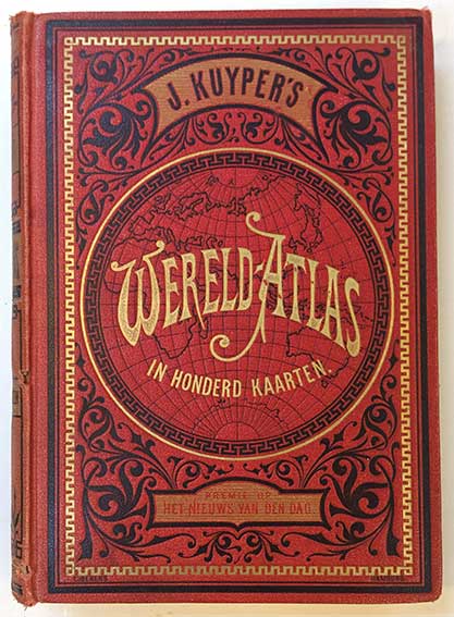
KUYPER, J. Wereld-atlas voor kantoor en huiskamer. Europa (&) Azie, Afrika, Amerika en Australie. Amst., 1880. 2 in 1 vol. W. 100 cold. maps, for the greater part double-p. Or. gilt & black dec. red cl. (Spine ends chipped, upper hinge weak).
uitslag € 90
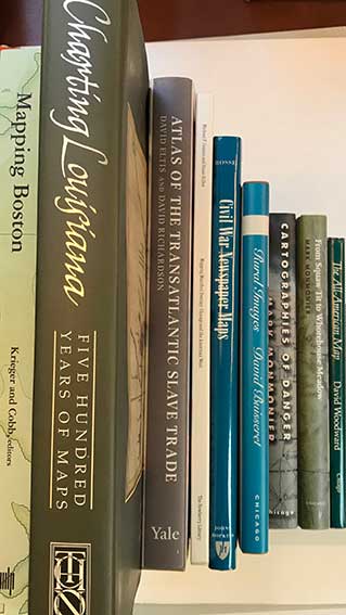
LEMMON, A.E., J.T. MAGILL & J.R. WIESE, eds. Charting Louisiana. Five hundred years of maps. 2003. 4°-obl. Obrds. w. dust-j. -- Added: D. ELTIS & D. RICHARDSON. Atlas of the Transatlantic Slave Trade. (2010). 4°. Ocl. w. dust-j. -- M. MONMONIER. From Squaw Tit to Whorehouse Meadow. How maps name, claim, and inflame. (2006). Ohcl. w. dust-j. -- Id. Cartographies of danger. Mapping hazards in America. (1997). Ohcl. w. dust-j. -- D. BUISSERET, ed. Rural Images. Estate Maps in the Old and New Worlds. (1996). 4°. Ohcl. w. dust-j. -- And 4 o. (9).
€ 80
MONMONIER, M. Rhumb Lines and Map Wars. A Social History of the Mercator Projection. (2004). Ocl. w. dust-j. -- J.P. SNYDER. Flattening the Earth. Two Thousand Years of Map Projections. (1993). Ohcl. w. dust-j. Standard work. -- J.R. AKERMAN & R.W. KARROW. Maps, Finding our Place in the World. (2007). 4°. Ocl. w. dust-j. -- J.R. AKERMAN. Cartographies of Travel and Navigation. (2006). Ocl. w. dust-j. -- And 10 o. (14).
uitslag € 75
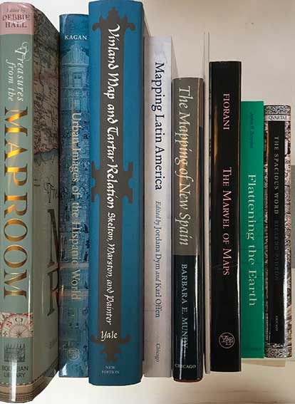
MUNDY, B.E. The mapping of New Spain. Indigenous Cartography and the Maps of the Relaciones Geográficas. (1996). 4°. Ohcl. w. dust-j. -- R.L. KAGAN. Urban Images of the Hispanic World, 1493-1793. (2000). 4°. Obrds. w. dust-j. -- Fr. FIORANI. The marvel of maps. Art, Cartography and Politics in Renaissance Italy. (2005). Lge-8°. Obrds. w. dust-j. -- R.A. SKELTON, (a.o.). The Vinland Map and the Tartar Relation. New ed. 1995. 4°. Ocl. w. dust-j. -- And 5 o. on the history of cartography. (9).
RADEFELD, C. & RENNER, L. Atlas Zum Handgebrauche für die Gesammte Erdbeschreibung. N.pl., Verl. des Bibl. Instituts, n.d. (=1841). (117) lvs. W. 115 steel-engr. maps, cold. in outlines. Obl.-8°. Fine cont., gilt tooled and gilt lettered green mor. Spine raised with 4 bands.
€ 180
SNYDER, J.P. Flattening the Earth. Two Thousand Years of Map Projections. (1993). Ohcl. w. dust-j. Standard work. -- R.J.A. TALBERT, ed. Ancient Perspectives. Maps and Their Place in Mesopotamia, Egypt, Greece, and Rome. (2012). Lge-8°. Ocl. w. dust-j. -- J.B. HARLEY & D. WOODWARD. Cartography in the Traditional Islamic and South Asian Societies. (1992). 4°. Ocl. w. dust-j. (The History of Cartography, Vol. II-1). -- (3).
VINGBOONS-ATLAS. Atlas van kaarten en aanzichten v.d. VOC & WIC, genoemd Vingboons-atlas in het Alg. Rijksarchief te 's-Gravenhage. (Verzameling v. pas-kaarten, dienende tot de vaart naar Oost- & Westindien). (Facs. ed. Haarl., Fibula-Van Dishoeck, 1981). W. num. (fold.) cold. plates & ill. Lge-fol. Or. blind tooled & gilt lettered cl. bind.
€ 120
uitslag € 120
WIGEN, K., S. FUMIKO & C. KARACAS. Cartographic Japan. A history in maps. (2016). 4°. Ocl. w. dust-j. -- J.R. SHORT. Korea. A Cartographic History. (2012). 4°. Ocl. w. dust-j. -- W. GOFFART. Historical Atlases. The First Three Hundred Years, 1570-1870. (2003). Obrds. w. dust-j. -- D. BUISSERET. Monarchs, Ministers and Maps. The Emergence of Cartography as a Tool of Government in Early Modern Europe. (1992). 4°. Ohcl. w. dust-j. -- And 3 o. (7).
€ 60
uitslag € 110