Veiling 349
Old & Rare Books - Atlases
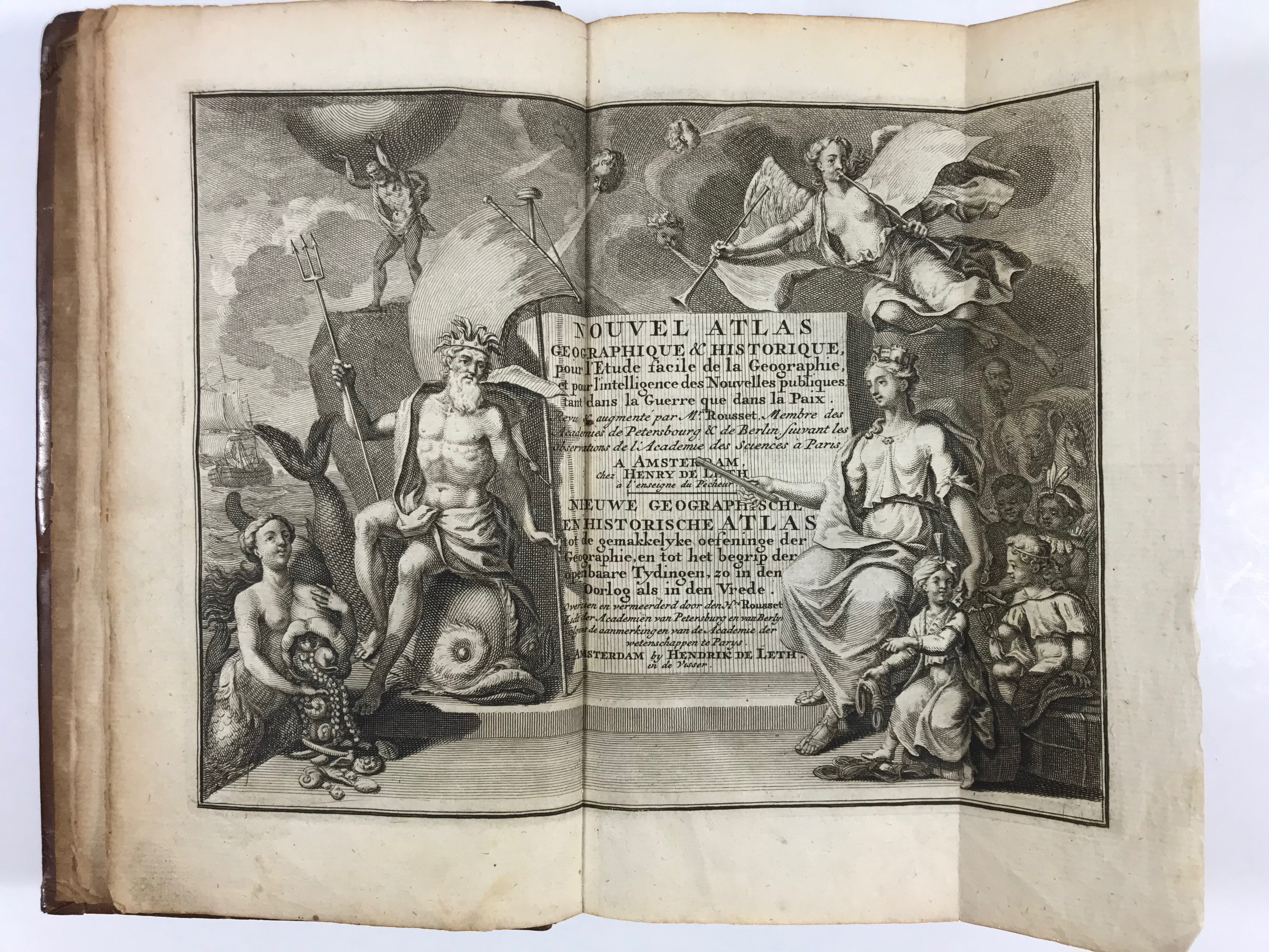
BAALDE -- NOUVEL ATLAS geographique et historique / Nieuwe geographische en historische atlas, tot de gemakkelyke oefeninge der Geographie, (...). Zamengest. d. (P.) Rousset, (...). Amst., H. de Leth/S.J. Baalde, (1770). (4), (148), (40) pp. W. engr. fold. ti., 34 maps (incl. worldmap) cold. in outlines, 2 cold. distance tables, 4 plain plates dep. terrestrial & celestial globes, and 1 plate dep. flags, all fold. Cont. cf. w. raised bands, dec. gilt back & brown label. (Joints (partly) split, spine a bit rubbed, upper margin a bit stained in places, slightly browned).
Meer info
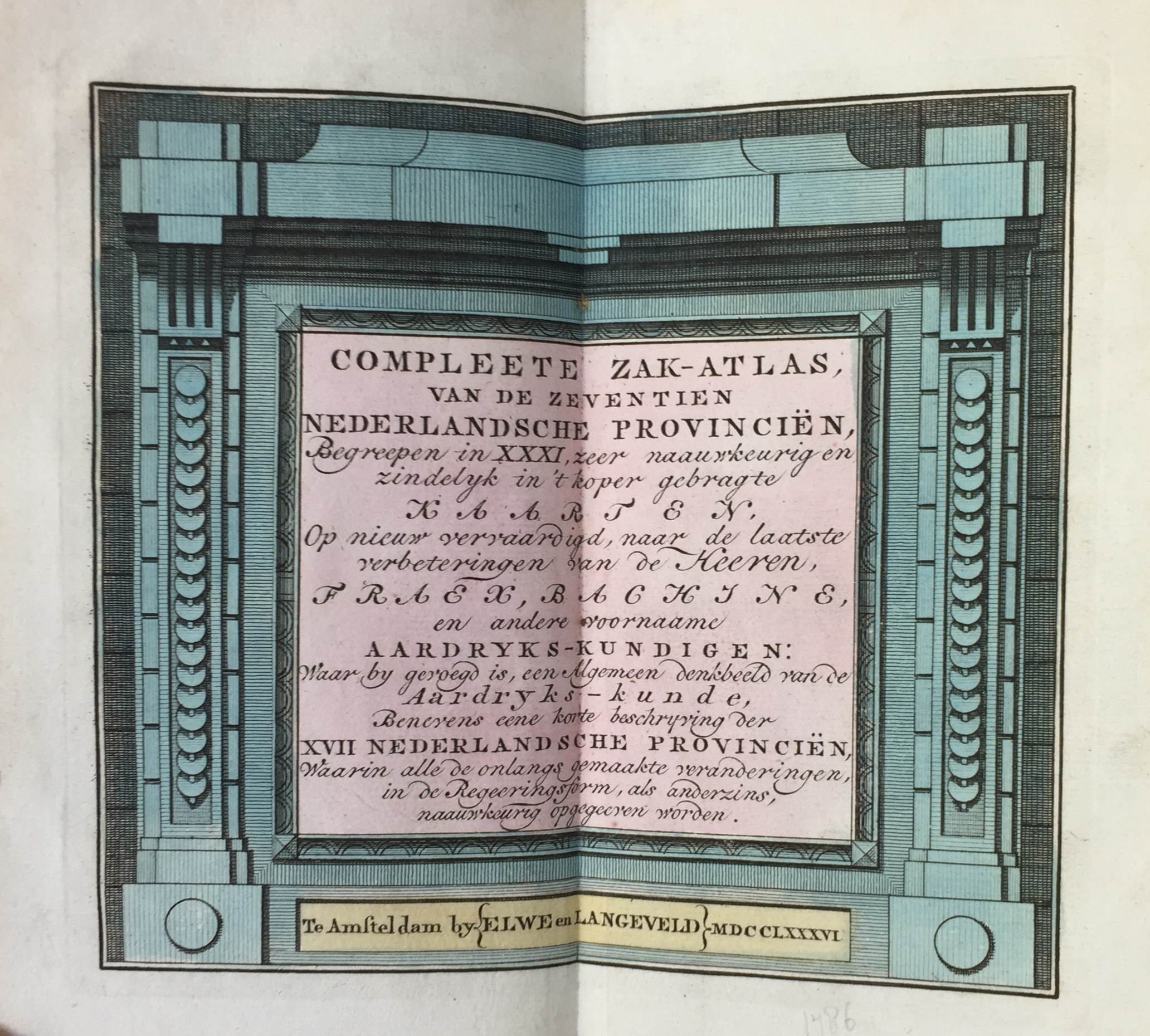
COMPLEETE ZAK-ATLAS, van de zeventien Nederlandsche Provinciën. Amst., Elwe en Langeveld, 1786. 243, (1) pp. W. engr. handcold. double-p. ti., 29 fold. handcol. maps (world, 4 continents and 24 maps of the Benelux) & 2 fold. tables. Cont. hcf. w. raised bands, dec. gilt back & black label. (Spine ends chipped, corners bumped, text a bit browned in places, else fine with the maps in very good condition).
Meer info
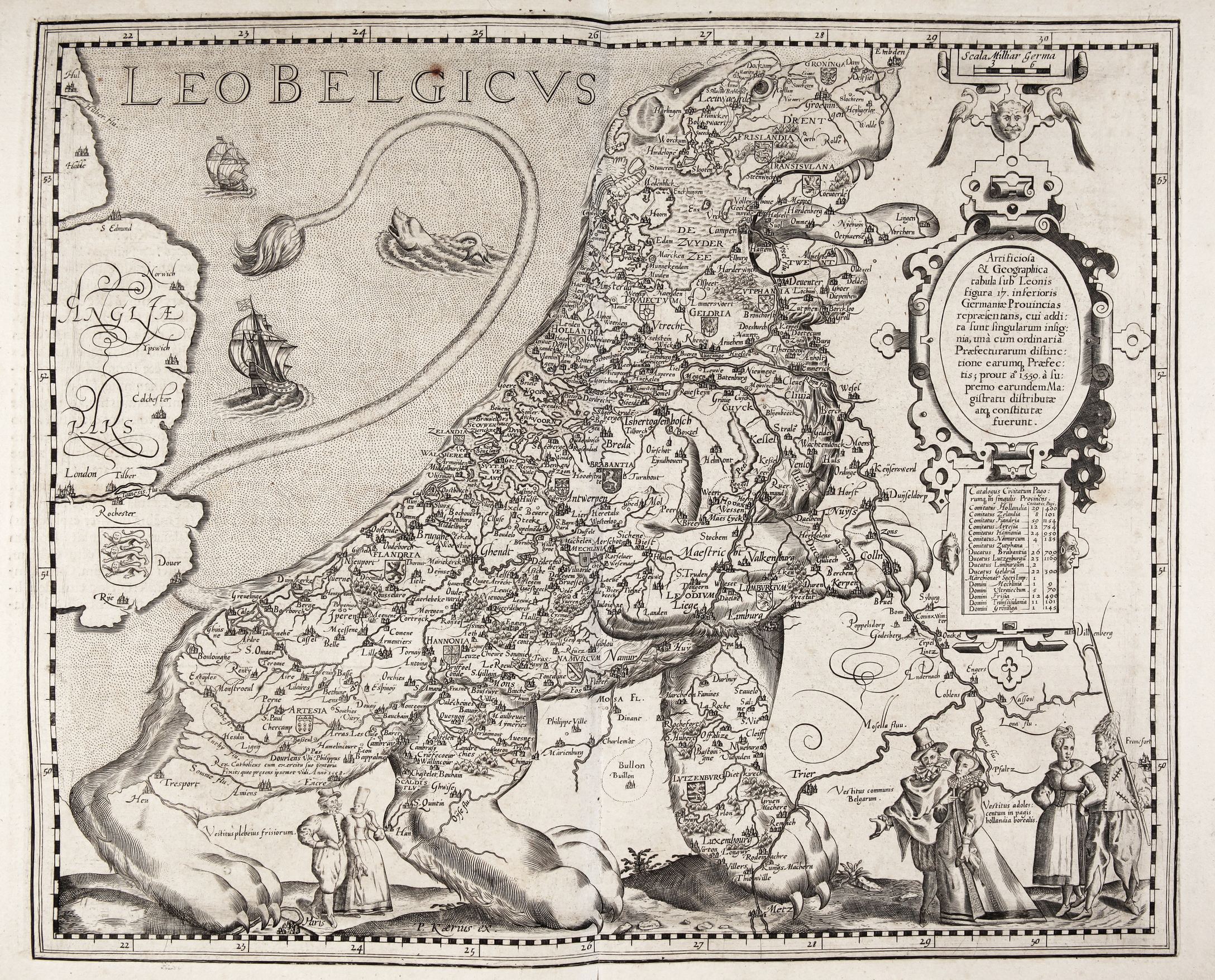
KAERIUS, P. (PIETER VAN DEN KEERE). Germania Inferior, id est, XVII Provinciarum ejus novæ et exactæ Tabulæ Geographicæ, cum Luculentis Singularum descriptionibus additis à P. Montano. Amst., P. Kaerius, 1617. (2), 94, (6) pp. W. engr. ti.-p. and 25 plain double-p. maps in text (of which 1 is actually a sequence of 5 historical scenes w. captions in Latin underneath and 1 small map, printed on 2 oblong copper plates). Fol. Cont. limp vellum w. overl. sides. (Ties fail, some age-toning/browning and unobtrusive traces of use throughout, map 'Geldria & Transysulana' printed upside down, last blank has some staining, but a superb and complete copy).
Meer info
Veiling 349
Old & Rare Books - Atlases