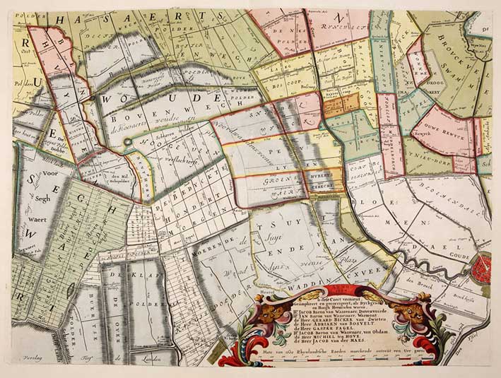
POLDER MAPS -- RIJNLAND -- (DOU, J.J. & S. v. BROECKHUYSEN). 't Hooge Heemraedschap van Rhynland. ((...) vernieuwd, geamplieerd en gecorrigeerd (d. M. Bolstra)). (Amst., I. Tirion, 1746). W. engr. title on 1 double leaf, 12 engr. maps on double leaves, 1 engr. map of Haarlemmermeer on 1 double leaf & 1 engr. table/plan on 1 double leaf, all (except engr. title) in marvellous cont. colouring. Lge-fol. Beautiful cont. panelled calf binding with 1 panel in a contrasting colour surrounded by gilt floral borders; thick floral border along edges, large lozenge shaped vignette consisting of floral ornaments in the centre, spine richly gilt and raised in 9 compartments. (Spine ends & corners slightly dam./chafed, else an outstanding copy with ample margins).
Third, corrected edition of this fine, coloured and detailed polder atlas of Rijnland in outstanding condition. The maps were engraved by David Coster after Melchior Bolstra's revision and augmentation of the second edition of 1687/88. The last plate represents the 'Concept sluijzen 1629' (representation of the sluices) near Katwijk. The maps can be assembled in such a manner that they form a large wall map. Donkersloot-De Vrij, 715 mentions the name of the publisher who can not be found on the maps themselves. He also states that the edition was limited to 650 copies only. - Koeman, Geschiedenis van de kartografie van Nederland, p. 138.€ 4000
uitslag € 3200
Terug