Lot 902
902
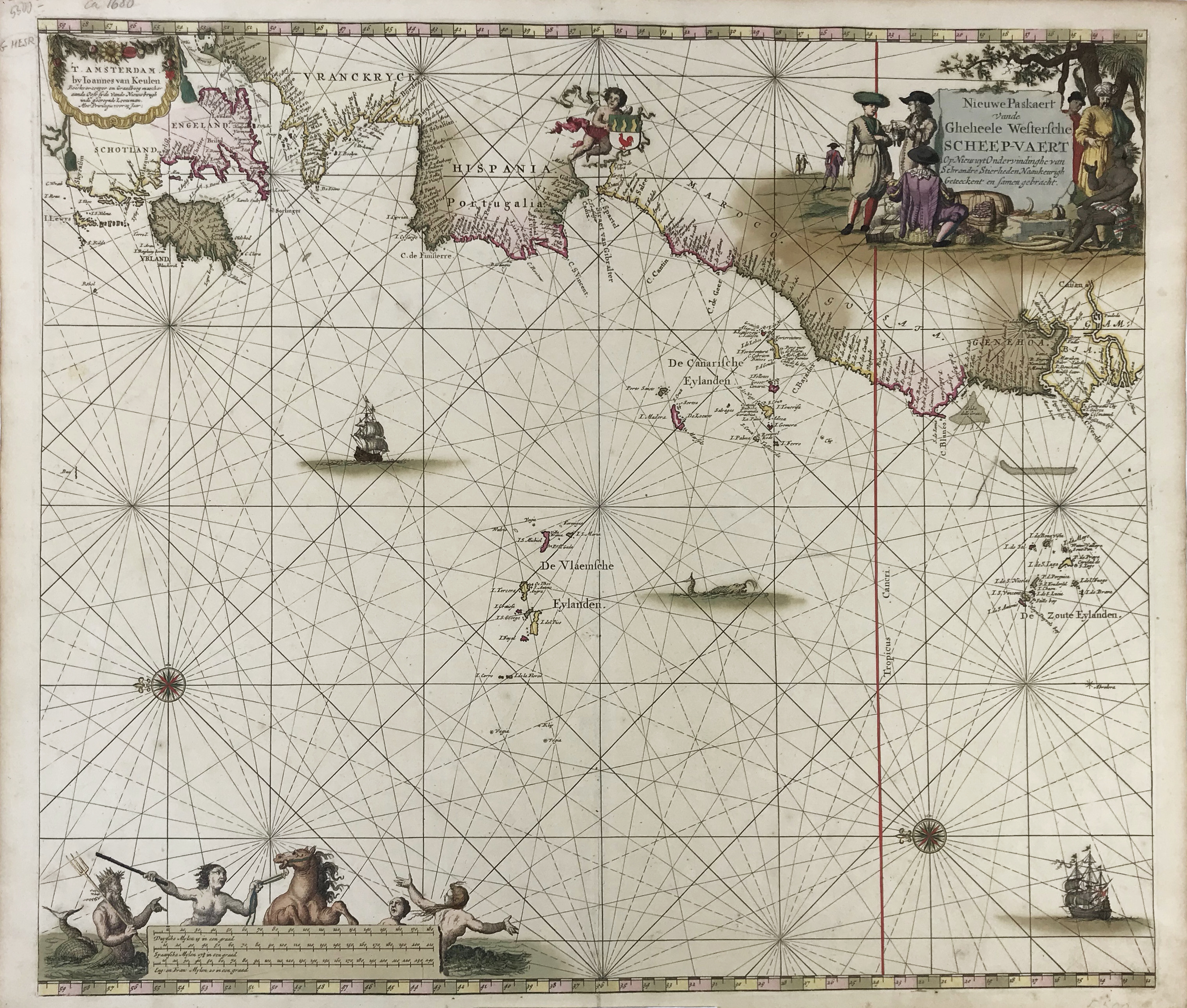
SEA CHARTS -- ATLANTIC -- "NIEUWE PASKAERT Vande Gheheele Westersche Scheep-vaert. Op Nieus uyt Ondervindinghe van Schrandre Stierlieden Naaukeurigh Geteeckent en samen gebracht". Amst., J. v. Keulen, n.d. (c. 1681). Cont. handcold. chart w. a few elements heightened w. gold, w. 2 elaborate inscribed cartouches, and coat of arms, depicting the Atlantic coastline from the Netherlands all the way down to Gambia. 512 x 590 mm.
Taken from 'De Nieuwe Groote, Lichtende Zee-Fackel'. First state (of 2). Cf. Koeman IV, p. 394.€ 300
Back