Lot 905
905
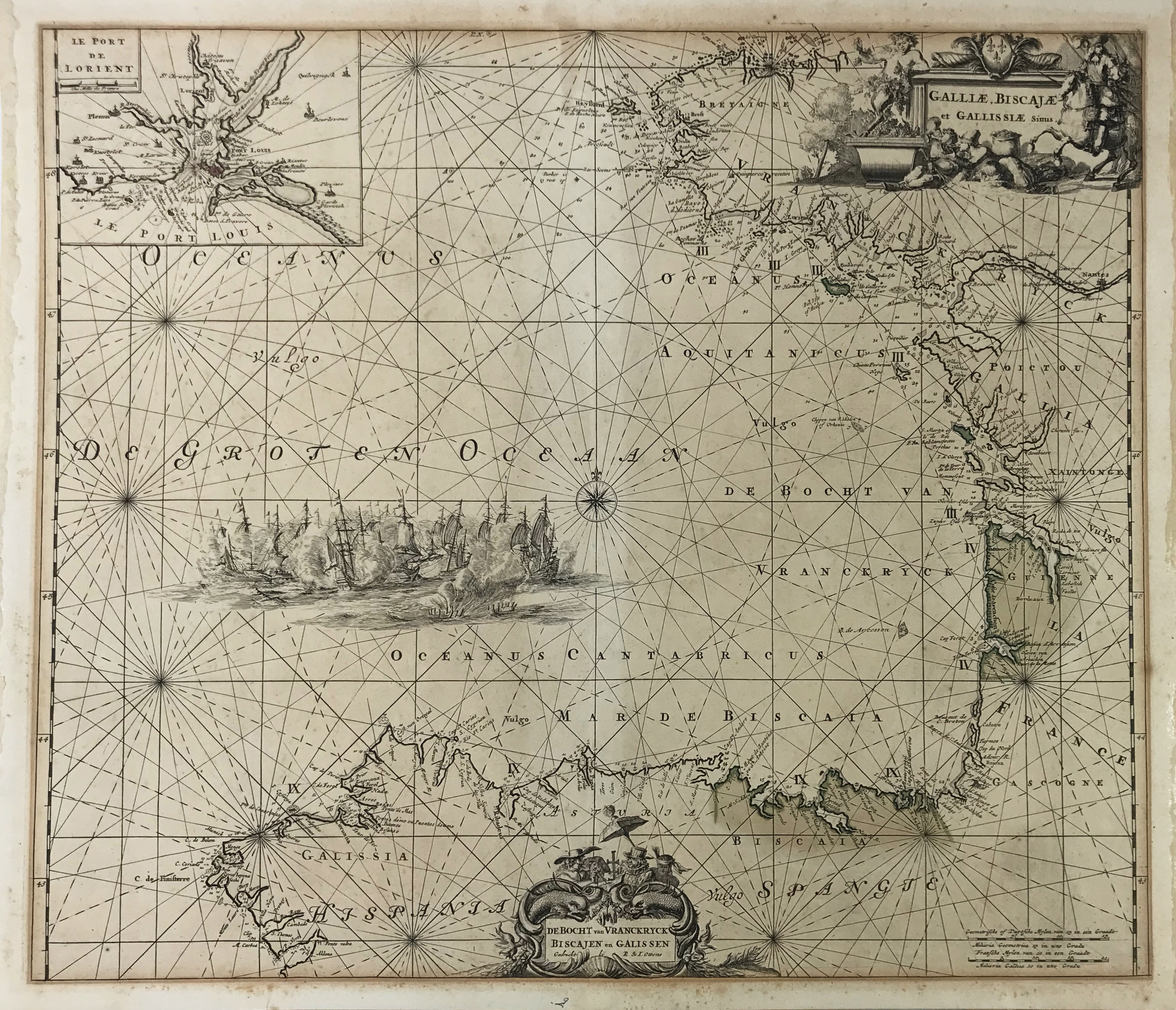
SEA CHARTS -- "GALLIÆ, BISCAJÆ et Gallissiæ Sinus/De Bocht van Vranckryck, Biscajen en Galissen". (Amst.), R. & J. Ottens, n.d. (c. 1720). Engr. chart of the coast of the Bay of Biscay, partly cold. by hand. W. large cartouche in the upper right corner, a smaller one in the lower centre and w. inset: "Le Port de Lorient" in the left upper corner. 490 x 560 mm. (A bit browned, traces of former framing along margins and on v°).
€ 150
Back