Veiling 348
Old & Rare Books - Atlases
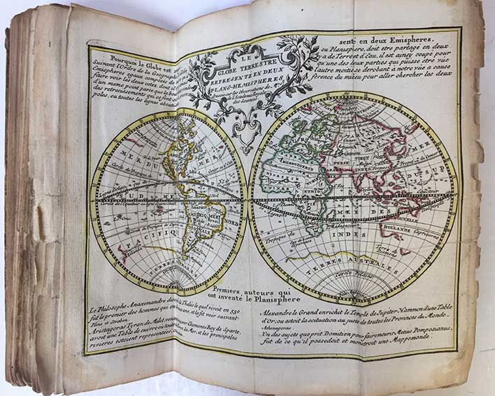
BAALDE -- NOUVEL ATLAS geographique et historique / Nieuwe geographische en historische atlas, tot de gemakkelyke oefeninge der Geographie, (...). Zamengest. d. (P.) Rousset, (...). Amst., S.J. Baalde, 1770. (202) pp. W. engr. ti., 33 maps cold. in outlines, 2 cold. distance tables, 5 plain plates dep. terrestrial & celestial globes, etc. and 1 plate dep. flags, all folded in three. Slim 8°. Cont. hcf. w. raised bands. (Sides rubbed, corners bumped/worn, margins of maps rather frayed/w. num. (small) tears, small piece of 1 map missing (2x1cm), a bit browned in places, a rather used copy, but with all the maps/plates).
Meer info
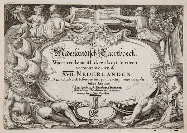
(DONCKER, H). Nieuw Nederlandtsch Caertboeck. Waer in volkomentlijcker als oyt te voren vertoont werden de XVII Nederlanden, Soo in't geheel, als elck besonder, met een beschrijvinge over de selve landen. Amst., H. Doncker, 1685 (& 1707). 24 pp. (incl. typogr. title!). W. engr. title and 21 (of 23). 8°-obl. Mod. brds., untrimmed. (A bit thumbed/traces of use, date on engr. title erased w. ink, lacking maps 'Belgium sive Inferior Germania' and 'Marchionatus Sacri Imperii', but in very good condition).
Meer info
GEOGRAPHISCH-TONEEL, Of uitgezochte kaarten, Tot gemak der Officieren, Reisigers en Liefhebbers. Amst., D. Weege, 1753. 16 pp. W. 41 fold. (some lge. fold.) double-p. maps, all cold. by hand. Tall-8°. Cont. h. sheepskin. (Bind. rubbed/chafed, small hole in spine, corners bumped/dam., most maps w. (small) tears/splits on folds, map 10 w. loose piece (but complete), some plates strengthened on back side, a bit browned in places).
Meer info
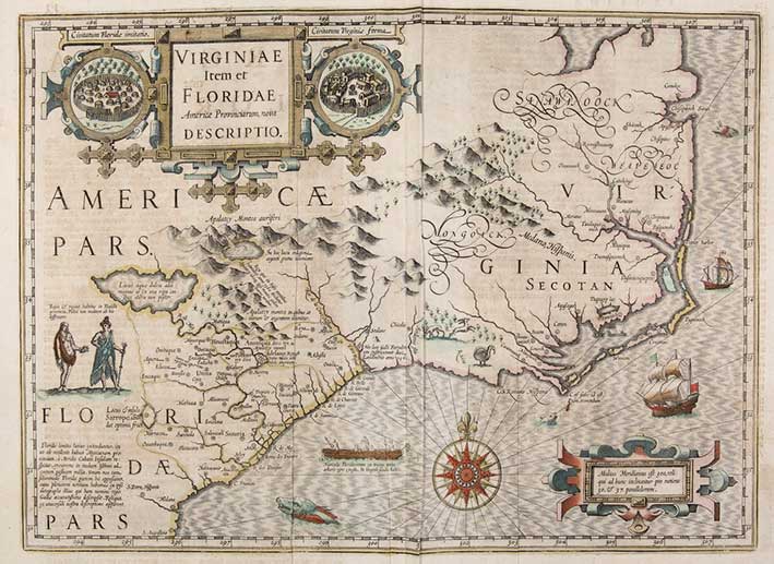
(MERCATOR, G. & J. HONDIUS. Atlas ofte Afbeeldinghe vande gantsche Weerldt. (…) Nu eerst uyt het Latyn in onse Nederlantsche Tale getranslateert. Amst., J. Janssen (Janssonius), 1634). W. 151 (of 183, perhaps 182) double-p. maps, with cont. outline colouring. Fol. No binding present. (Maps a bit rumpled/misfolded in places, splits and tears in places (sometimes running into image), margins dam. in places, atlas once subject to damp/humidity (w. resultant traces: faint stains, browning, faded colours and very faint stencilling in places), but maps in general in reasonable/good condition (espec. at the end of the atlas)).
Meer info
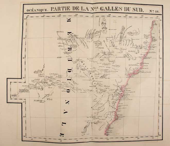
VANDERMAELEN, Ph. Atlas Universel de Géographie Physique, Politique, Statistique et Minéralogique. 6me partie: Océanique. Brux., 1827. (2) lvs., general lithogr. double-p. map and 60 lithogr. double-p. maps by H. Ode, all cold. in outlines. Lge-fol. Cont. hcf. backed marbled brds. (Spine renewed, outer corners a bit dam., first 2 lvs. a bit stained at borders, maps 59 & 60 w. small wormhole in blank margin, but maps surprisingly clean and in very good condition).
Meer info
Veiling 348
Old & Rare Books - Atlases