Kavel 901
901
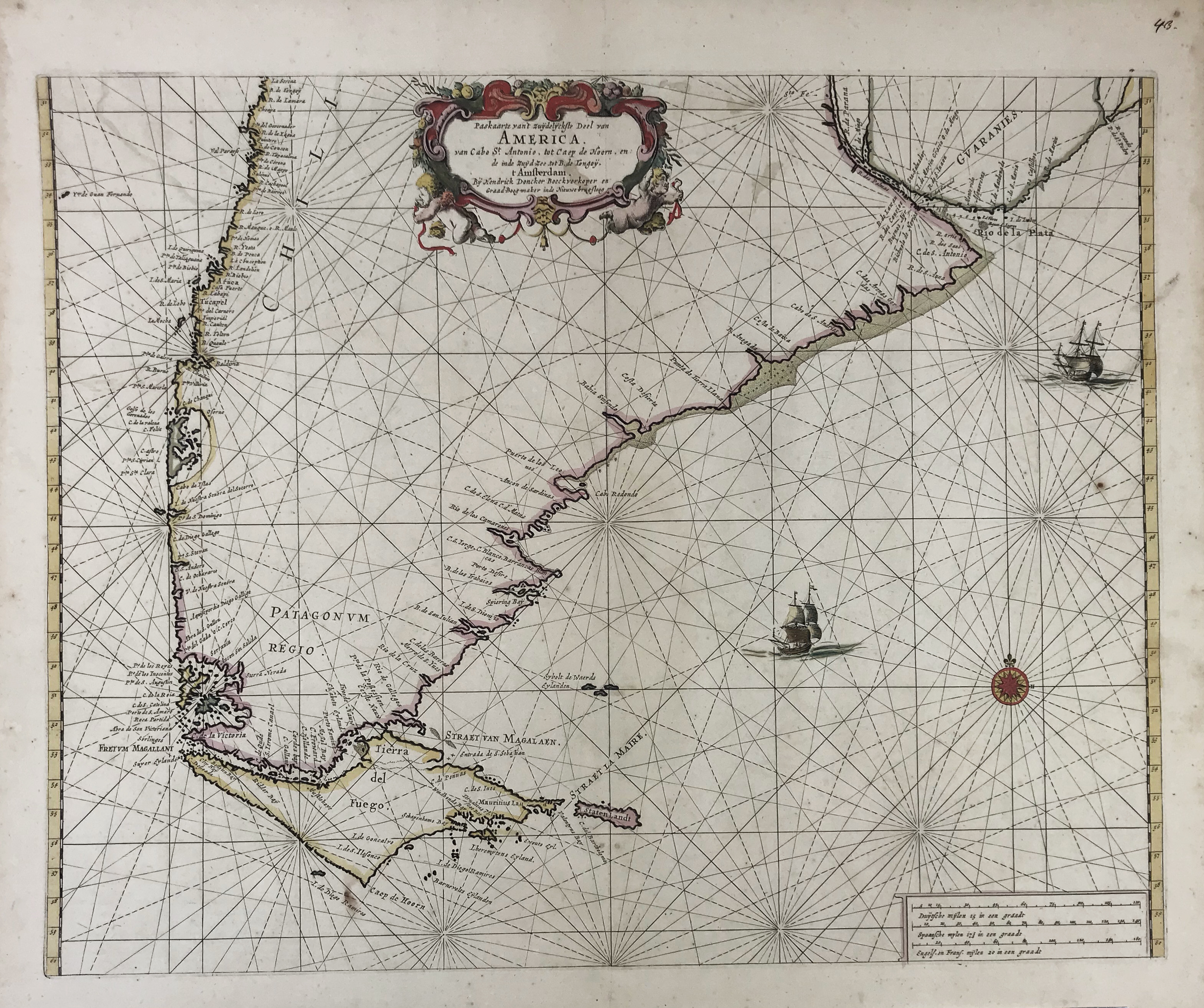
SEA CHARTS -- AMERICA -- "PASKAARTE van 't Zuijdelijckste Deel van America v. Cabo St. Antonio, tot Caep de Hoorn, (…)". Amst., H. Doncker, n.d. (c. 1660). Handcold. chart w. inscribed cartouche, ships, scale indicator and compass card, depicting the Atlantic coastline from Rio de la Plata all the way down to Cape Horn. 430 x 536 mm.
Taken from 'De Zee-atlas of Water-werelt'. Koeman IV, p. 159.€ 150
Terug